What do mangroves, hurricanes and roads have in common?
They’re all part of Southwest Florida’s coastal environment. Mangroves and hurricanes are natural; roads are not. And hurricanes and roads can have major effects on mangroves.
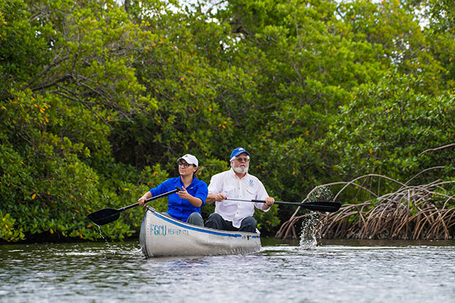
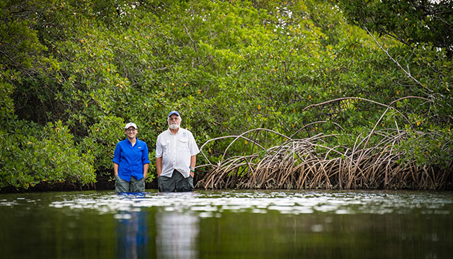
Working with Win Everham, professor of environmental studies, graduate student Gianna Diaz is finishing up a project to determine how hurricanes and roads affect the area’s mangrove forests.
“I have lived in Clearwater my whole life and I’ve always seen mangroves while driving to the beach and boating but never understood why they created these islands,” said Diaz, who is working on her master’s in environmental studies. “Then I got to FGCU and started working with Win, who had started a project at Vester [Marine Field Station] looking at how Hurricane Irma affected a mangrove island there. Helping with that work got me interested in how a hurricane will affect a forest that has been hit over and over again by hurricanes throughout history. Then Win came up with the idea of multiple disturbances, and I knew that was my project.”

Southwest Florida’s three mangrove species — red, black and white — play many important roles in the environment: They protect shorelines from erosion; they provide habitat for fish and marine invertebrates, mammals, birds, reptiles and amphibians; they help maintain and improve water quality by trapping sediments and filtering out pollutants.
Mangroves will play an increasingly important role as the climate continues to change, Everham said.
“The climate is changing, and mangroves are at the leading edge of the change,” he said. “As temperatures get hotter, hurricanes and tropical storms will become more intense, and mangroves will be right there: Mangroves protect us against storm surge. If we protect mangroves, we protect our shorelines. If not, not. When Gianna started her graduate studies, we talked about how different disturbances affect mangroves.”
Diaz’s work is in the field of disturbance ecology, or how disturbances affect specific habitats – a disturbance is often defined as “any relatively discrete event in time that disrupts ecosystems, community or population structure and changes resources, substrate availability or the physical environment.”
For her study, Diaz established 27 plots across five locations, called regions, in Sarasota, Lee and Collier counties. In some plots, roads blocked the natural ebb and flow of the tide; in other plots, roads did not restrict tidal flow.
“Gianna is looking at the relationship between hurricanes and roads to see if there is more damage where there is no flooding,” Everham said. “Lack of flooding creates stress. Nature does not build roads. Add in the stress of hurricanes, and you have a one-two punch.”
Two of Diaz’s mangrove regions had been hit by Hurricane Irma, one by hurricanes Irma and Wilma, one by hurricanes Irma and Charley, and one by hurricanes Irma, Wilma, Irene and Andrew.
At each plot, she measured seedling densities, sapling densities, tree densities, hurricane damage, diameter at breast height (DBH) of trees and canopy openness.
“I wanted to look at how hurricanes and tidal interruption caused by roads affect mangroves,” Diaz said. “I looked at mangrove forests that had been split by roads and that had been hit by hurricanes in the past 27 years [dating back to Hurricane Andrew in 1992]. I’m looking at hurricane damage to adult trees; I’m looking at the different species’ saplings and seedlings and how they are changing with hurricanes and tidal restrictions to see what they will look like in the future.”
As sea level rises with climate change, mangroves can migrate landward to keep from being inundated and to maintain their preferred salinity, but roads through mangrove forests might prove fatal for some forests.
“Forests that are cut off by roads have nowhere to go,” Diaz said. “When the water gets too high, they’re going to die off, which is not good.”
Diaz has completed collecting data and is working on the final edit of her thesis.
“I’m still doing some analysis,” she said. “It’s pretty interesting. One site by Goodland with restricted flow has some really odd patterns: It has really low tree diversity and lower seedling counts. The site gets king tides (exceptionally high spring tides) occasionally, and when you inundate a restricted forest, it can’t flush because of the road.”
She also found that some of her mangrove forests don’t follow the traditional “zonation pattern,” in which red mangroves grow along the shoreline, with their prop roots in the water, while black mangroves grow farther inland, and behind the black mangroves grow white mangroves.
“It’s all crazy — different in a good way,” Diaz said. “Overall, seedling recruitment is still really high. A lot of mangroves die in the sapling stage. But they’re still thriving. We can look at the seedlings and the saplings and say what mangrove forests will look like in the future, and there are going to be mangrove forests in the future.”
Of course, doing science in a mangrove forest isn’t like doing science in a nice, clean laboratory.
“Working in the mangroves was tough for sure, so many bugs and so much mud and constantly climbing over prop roots,” Diaz said. “We like to call it a hot, muddy jungle gym with spiders. But it was also very relaxing in a way. One minute you’re parking the car on this road where there are bikers and drivers and walkers, then you walk two meters into this forest and it’s like you’re on a different planet (in a good way), surrounded only by the animals that love that hot, muddy jungle gym and trees.
“Being in mangroves was hard, but it was also comforting knowing that whatever was going on outside the forest didn’t matter, we just had to focus on not falling and collecting our data.”
