Contributors: Laurie Babcock & James Greco, Photos
5 – minute read
In one of the earliest sonnets in English, Edmund Spenser illustrated the futility of carving a name into the sandy shore of a local beach when he wrote, “One day I wrote her name upon the strand, / But came the waves and washed it away.”
Christopher Daly, assistant professor in The Water School at Florida Gulf Coast University, researches how storm waves wash away more than just names in the sand — and what local municipalities can do to prevent further damage to Southwest Florida’s beaches.
“Waves and tides move sediment along our coasts, shaping it into the landscape we see today,” Daly says. Understanding how Florida’s coasts are affected by storms will better prepare local leaders to adapt.
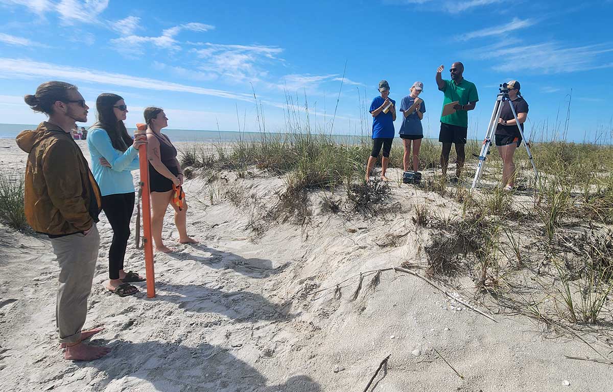
Christopher Daly’s coastal dynamics class trekked to Sanibel to measure beach erosion.
In 2022, Sanibel Island, Fort Myers Beach and Pine Island bore the brunt of Hurricane Ian’s Category 4 winds and storm surge upon landfall. Since then, Daly’s coastal dynamics class has trekked to Sanibel to measure beach erosion.
“By repeating these surveys at the same location, we can get a history of shoreline change with time,” he says.
On a Saturday morning in February, he brought his students to Sanibel’s Tarpon Bay Beach to survey two ebb surge channels carved deep by Ian’s storm surge. One such channel west of mile marker 4.5 serves as a walkway to and from the waterfront and is nestled between two dune mounds. Atop one, Daly and six students set up surveying equipment and he demonstrates how to take height measurements at regular intervals along the path.
The measurements taken from the back of the dune down to the surf will establish the beach’s profile or change in elevation. This simple but important statistic will tell Daly whether the area is accreting (accumulating more sand and sediment) or eroding (gradually wearing away).
While the profile team works in the dunes, Daly gathers the wave team at the shoreline. They have a heavy-duty meter stick, an open reel tape measure and a pressure sensor clipped by carabiner and rope to a yellow buoy tagged “FGCU research: please do not disturb.”
“Those of you going out into the water, not further than waist deep,” Daly announces.
The shortest member of the team refuses to go out and everyone laughs, but she’s not the only one reluctant to get in the water. White-capped peaks churn and crash against the sandy shore. The rip current forecast level is “moderate,” so Daly takes the pressure sensor 30 meters into the surf while two students who joined him in the water stay closer to shore.
The rest of the wave team remains dry on land, even avoiding the swash or the turbulent water that washes up on the beach after an incoming wave breaks.
During a hurricane, wind pushes water from the ocean toward shore, where it combines with the normal tides to form a storm surge. Ian’s surge increased the water to 13 feet on Sanibel. After setting the pressure sensor 30 meters out, Daly and the two waterlogged students use the meter stick to estimate the day’s breaking waves at 2 feet.
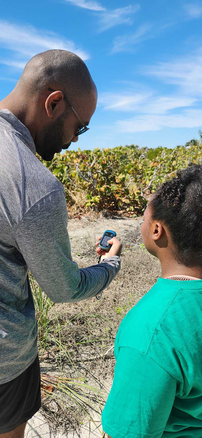
Daly shows a student how to use the handheld GPS unit.
Daly walks out of the Gulf of Mexico to find the sediment team. Using plastic bags, labels, markers and a trowel, their task is to take samples of sediment and sand for testing back at The Water School.
“Waves and tides move sediment and shape the land in which millions of people live. Considering the expected effects of climate change, knowing how sandy coasts will evolve in the future presents a challenge for society in how we are able to adapt,” he says.
He notes some of those adaptations will affect Southwest Florida’s sediment budgets or the balance between sediment added to and removed from the beach.
His research helps inform local governments about the types of mitigation efforts that work best to keep sand and sediment on the beach during a storm.
Two hours later, Daly and his students move to a point a quarter-mile east on Sanibel. The profile, wave and sediment teams repeat their processes to compare data from the two sites once they return to the classroom.
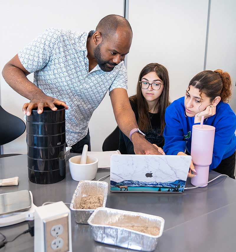
Back in the classroom, Daly goes over data with students Kylin Meredith, center, and Julie Rafael.
There’s a certain redundancy to doing the work this way. Except for taking sediment samples, most of the data collection done by the students can be accomplished faster using a geographic information systems (GIS) drone. Daly and his Water School colleagues documented the post-storm overwash in January, and FGCU graduate students are working with faculty to analyze the data.
So why is Daly teaching the older, slower methods of data collection? For the same reason schools teach long division when calculators exist: The initial exposure to “old school” methods is crucial in developing critical-thinking skills and problem-solving abilities.
“While data can be collected quicker using tools such as drones and GIS, there’s still value in using slower methods,” says Sophie Kegler, one of the field trip participants. The Orlando native majoring in marine science says using these methods allows students like her to learn about the effects on beach profiles, wave interactions and sediment transportation, and lets students verify data collected in the technology-based methods.
In the afternoon, the students pack up their equipment and wait for Daly to retrieve the pressure sensor for the last time. He steps out of the Gulf, leaving behind nothing but footprints.
But it’s high tide — and so the waves come and wash them away.